Essays, Maps, Data and Tutorials from the Mapping Early American Elections Project
May 13, 2019Today the Mapping Early American Elections team is making their final release of maps, data, and essays for this project. We have four main elements that we are adding to the site, in addition to the hundreds of state-level maps of Congressional elections during the first-party system that we have already released. First, we are publishing six essays and a bibliography that give you an overview of the history of early American politics and a... Read more →
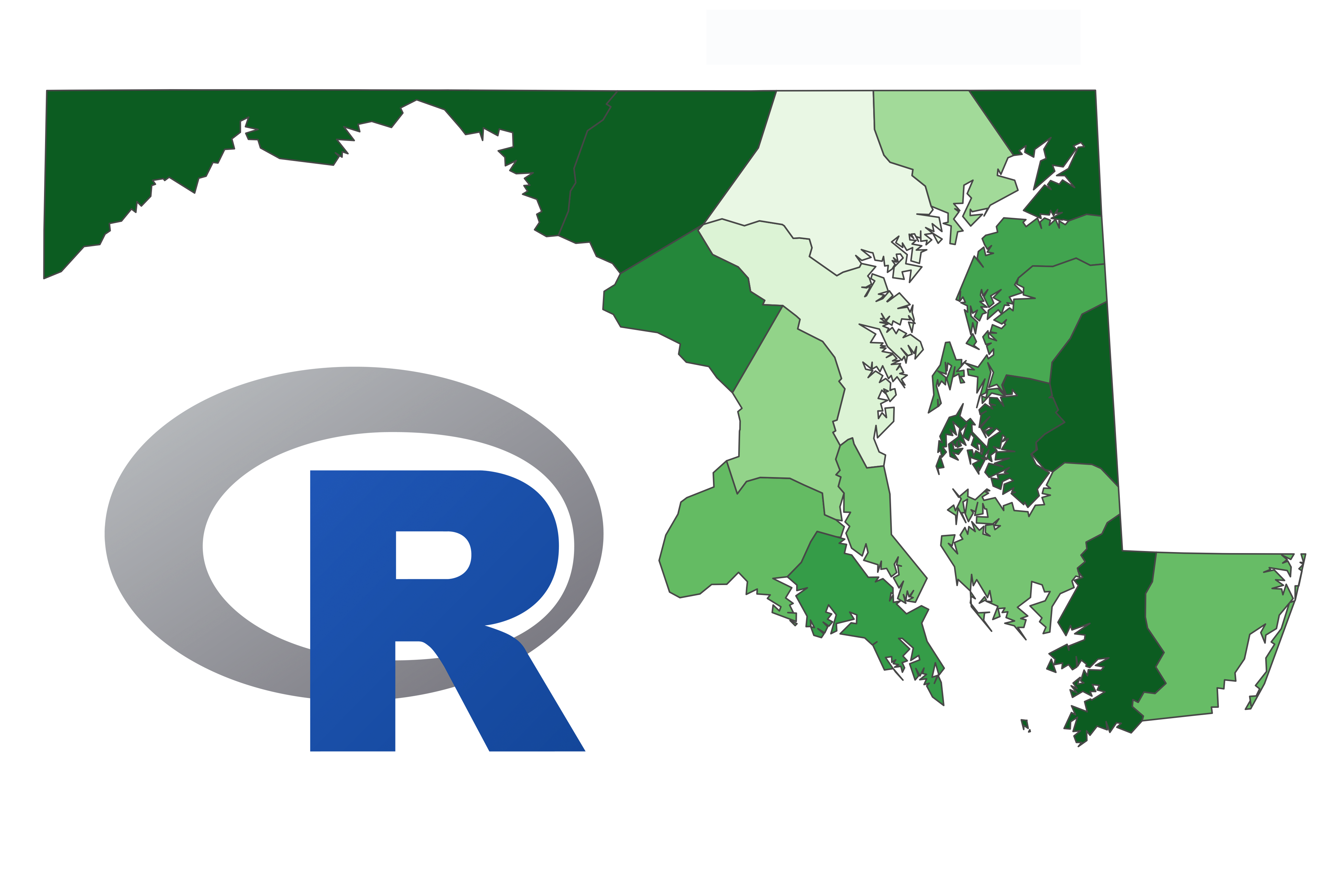
R Tutorial
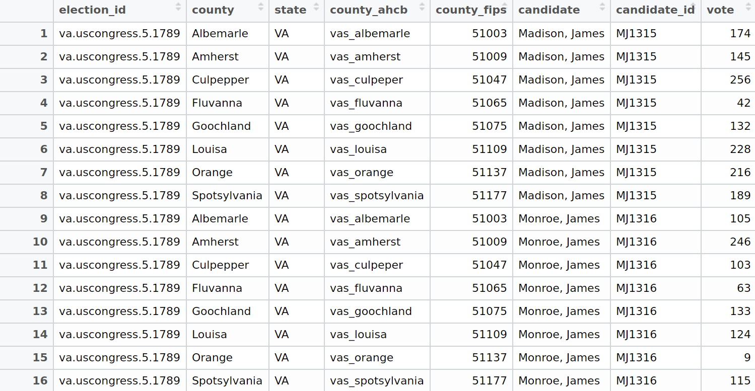
April 30, 2019Enjoyed looking at the maps featured on the Mapping Early American Elections (MEAE) site? Wish you could utilize the MEAE dataset to make your own maps, but are not sure how to get started? You’re in luck! The following tutorial will teach you how to combine MEAE data with historical geospatial data to create basic choropleth maps (maps which show geographic regions colored or shaded according to some variable) in R. While we are going... Read more →
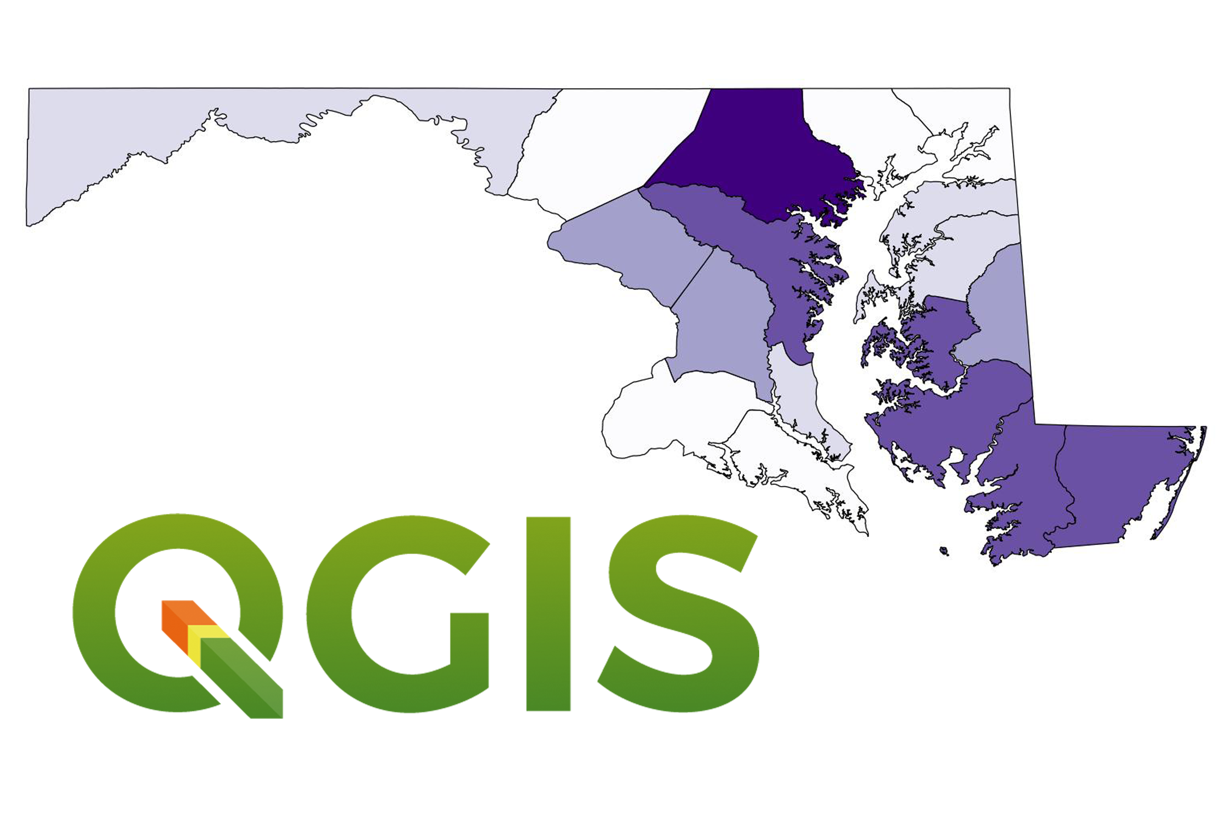
QGIS Tutorial
April 30, 2019Enjoyed looking at the maps featured on the Mapping Early American Elections (MEAE) site? Wish you could utilize the MEAE dataset to make your own maps, but are not sure how to get started? You’re in luck! The following tutorial will teach you how to combine MEAE data with historical geospatial data in QGIS to create basic choropleth maps (maps which show geographic regions colored or shaded according to some variable). While we are going... Read more →
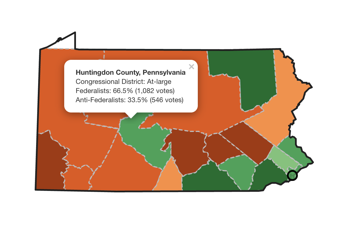
How To Use Our Maps
April 30, 2019Exploring maps on the Early American Elections site is simple! Here are four steps to get you started: On the Maps page, select a Congressional session from 1788 to 1825. The National map provides a view of results for congressional elections for the entire country for that congress. For individual states, click on the state’s name. State maps provide granular detail about voting at the county level (if available). Navigate the map in several ways:... Read more →
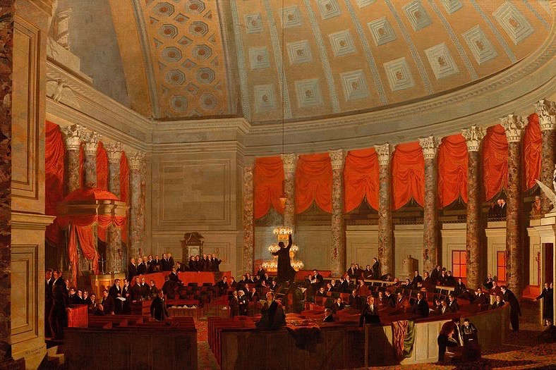
Mapping Congress in the Era of the First Party System
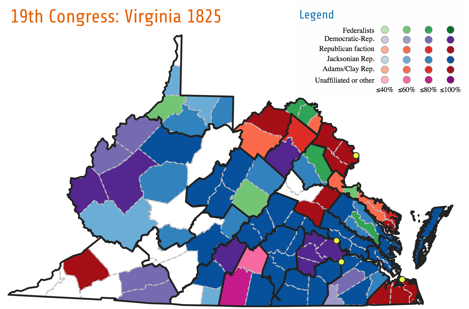
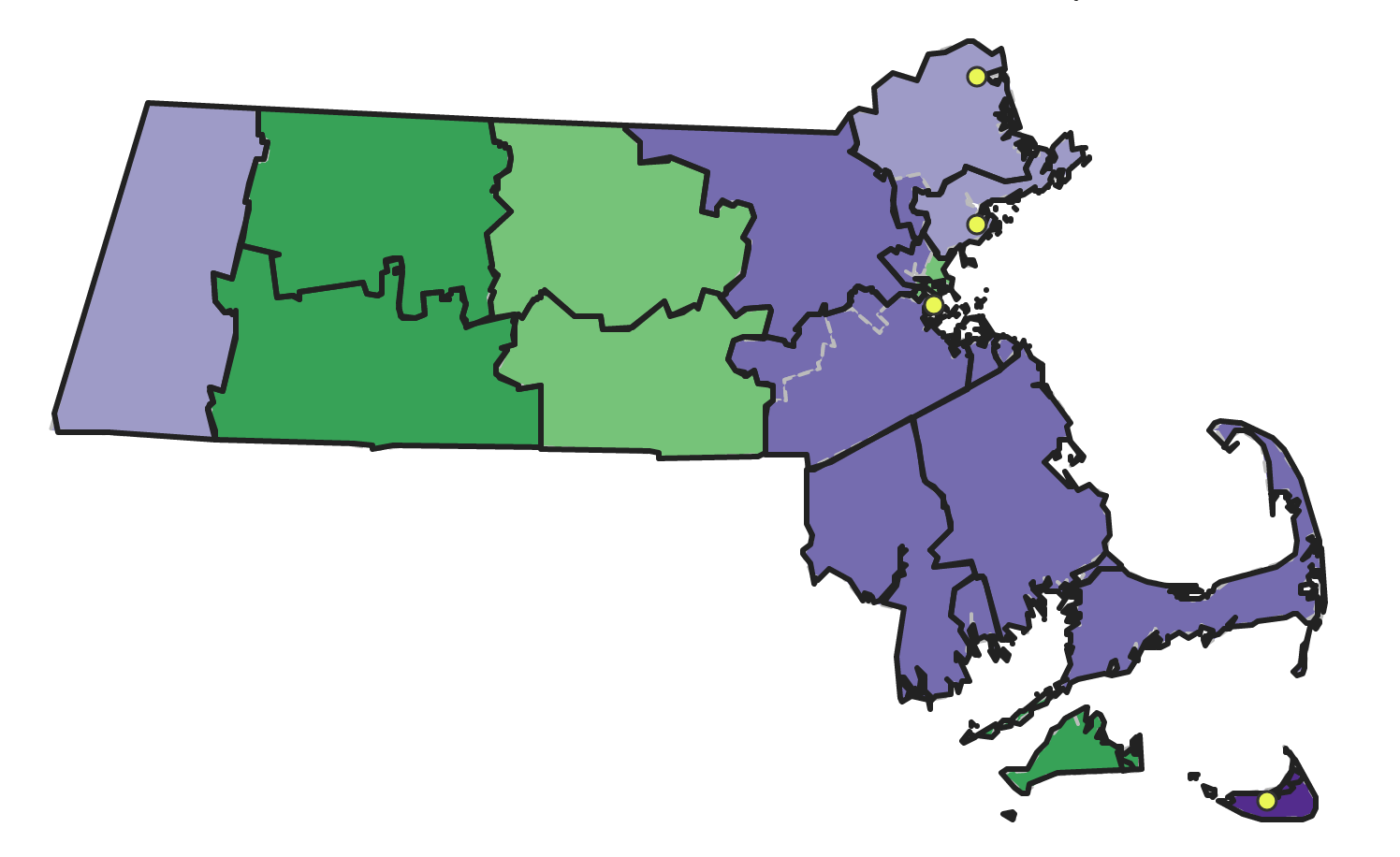
November 6, 2018As Americans go to the polls to vote for their representatives to Congress on Election Day, the Mapping Early American Elections team invites you to examine maps from the first four decades of Congressional elections. In addition to the maps of the first ten Congresses we released previously, today we are releasing maps of 24 states for elections to the 11th through 19th Congresses. This release completes our run of state-by-state maps of county-level returns... Read more →
Mapping the Second Decade of Congressional Elections
April 17, 2018The Mapping Early American Elections team has released over eighty maps of elections for Congress’s second decade. This release adds county-level maps of election returns for the Sixth through Tenth Congresses, taking our coverage of Congressional elections up through the 1806–1807 elections. As before, these maps are accompanied by tables that succinctly summarize the results for each district or state-wide at-large election, and which link out to the Biographical Directory of the United States Congress.... Read more →
Mapping the First Decade of Congressional Elections
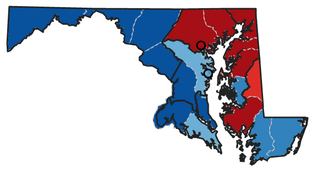
December 13, 2017Districts flip, party affiliations change, and populations and geographies shift. These and other changes are visible in the project’s first release of over 70 maps visualizing county voting returns by state from the first five U.S. Congressional elections. The project will regularly release additional Congressional maps through the nineteenth Congress in early 2018. Shifting votes for parties in the first three Congressional elections in Maryland. The new Maps section invites users to browse by Congress... Read more →
What Did Democracy Look Like? Voting in Early America
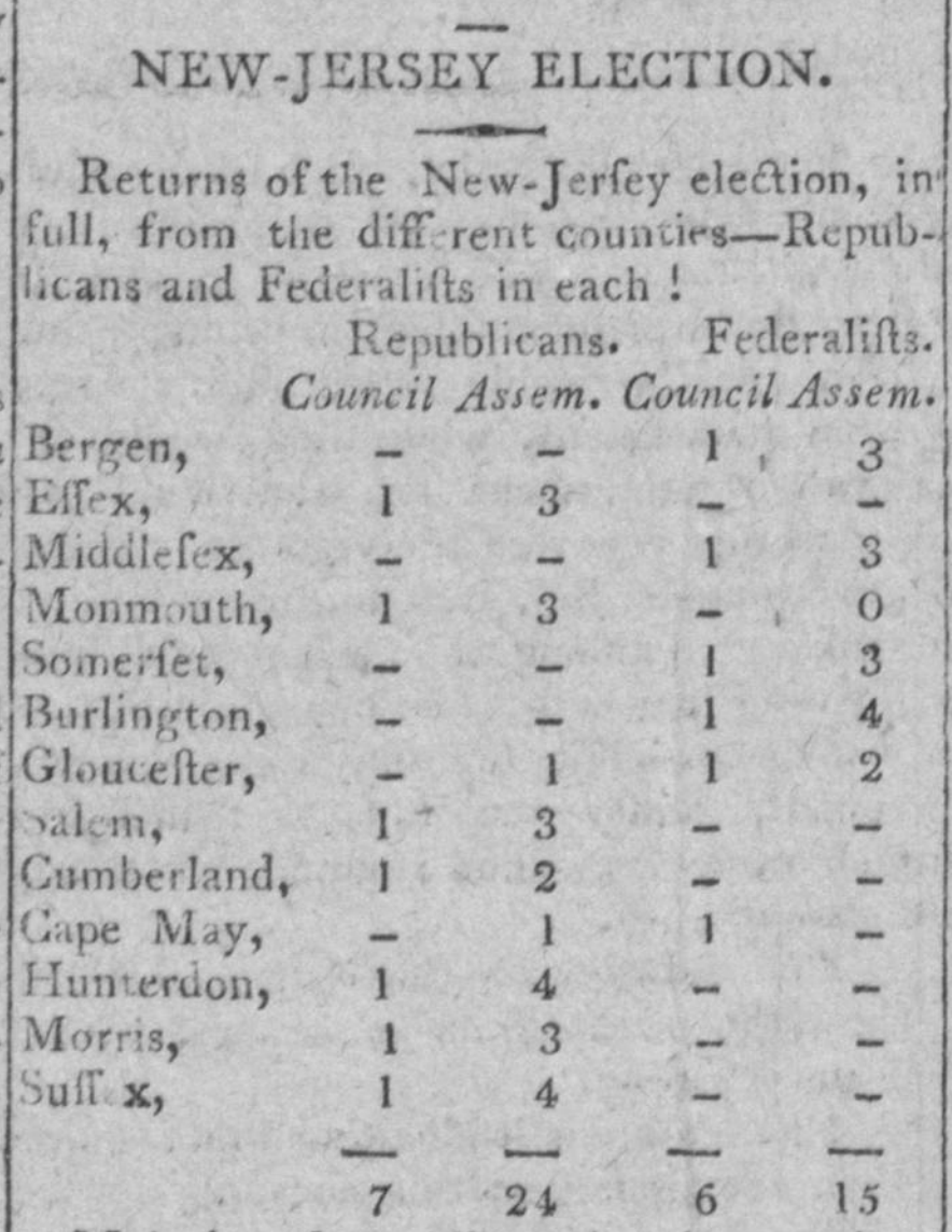
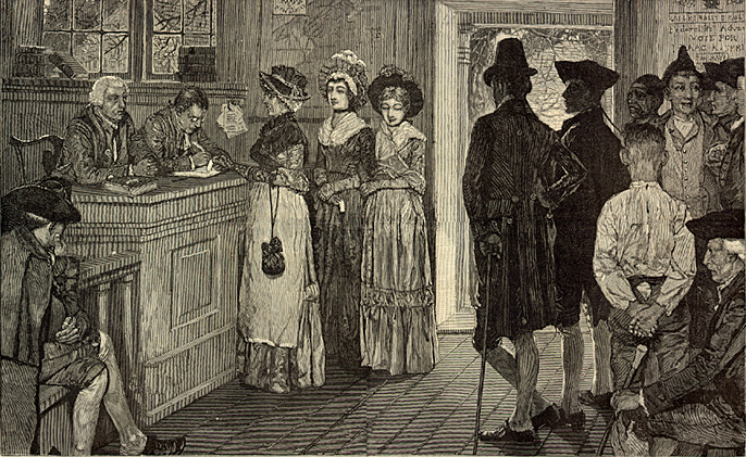
September 1, 2017Early American elections subvert conventional notions that portray the development of early American democracy as an orderly or systematic affair. In contrast to the well-organized procedures governing voting procedures today, elections during the first few decades of the new nation’s existence were often haphazard affairs. Everything from the location of the polls to the qualifications of the electors to the number of days the polls would be open varied from state to state, and often,... Read more →
Geolocating the Towns from A New Nation Votes
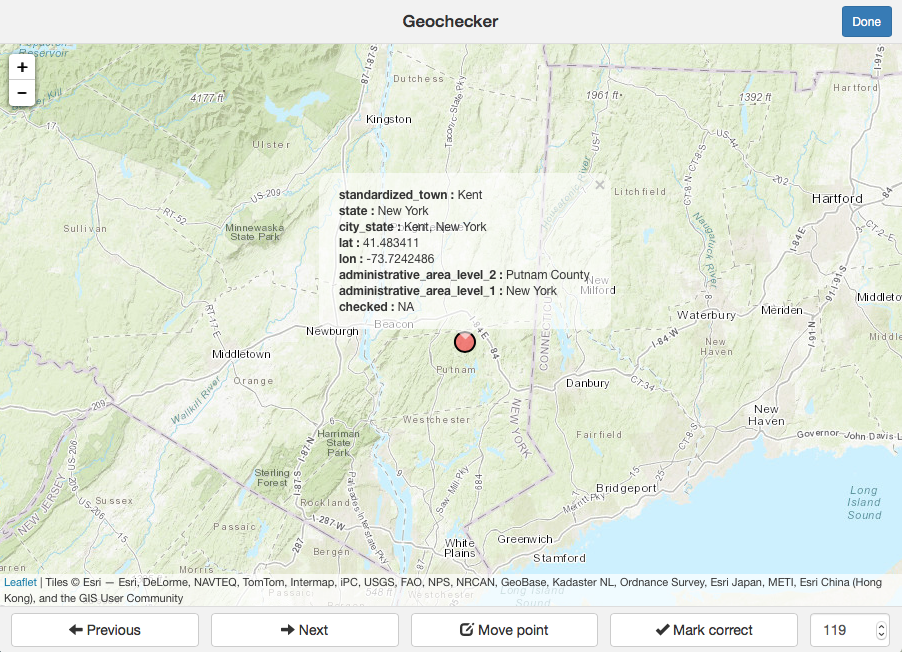
August 22, 2017What do the towns of Middle Hero, Vermont, Castleton, New York, and Enfield, Massachusetts have in common? They all have voting returns in the New Nation Votes dataset (NNV) and they don’t exist anymore. NNV contains voting returns at the town, county, and Congressional district level. This geographic information is limited to general place names only (e.g., the town of Suffrage, Otsego County, the tenth Congressional district in New York). Before these locations can be... Read more →
How Mapping Elections Is Different From A New Nation Votes
April 19, 2017Mapping Early American Elections is based on the records collected in an earlier project, A New Nation Votes (also funded by the NEH). This project has been providing scholars with access to election returns from the early republic for a number of years. So what exactly is our project adding to these election returns, and how is it making them more accessible? The best way to understand the difference between the two projects is that... Read more →
Introducing Mapping Early American Elections
April 11, 2017The Mapping Early American Elections team is pleased to launch the project website. During this three-year project, funded by the Division of Preservation and Access at the National Endowment for the Humanities, we plan to blog about our process and progress. Our project is building on the New Nation Votes (NNV) collection of electoral returns, a project that was also funded by the NEH. Mapping Early American Elections is turning those election returns into a... Read more →
